Once I wholeheartedly decided on traveling the length of the river, it was time to get down to some detailed research and planning. I would say it took me about 3.5 months casual planning and research, and then about 30 days of serious getting ready. Keep in mind that I did not own a kayak previous to this trip, nor have experience with one, so the bulk of my efforts were directed at this item.
 If you already have a boat, a smart phone, and have a way to get there and back, I honestly think you could spend about a week getting your gear together and ordering maps from the USACE and then hit the road. There are ample places along the river to stop for food, water, and supplies. You’ll have plenty of time during your paddling to plan your next several days worth of travel.
Here are some topics that I considered at great length, which may be an aid to your own planning.
How Long Will It Take?
The river is 2,340 miles. 1,206 to St Louis; and another 1,134 to the Gulf. I estimated the current to be 1.5 mph above St Louis and 3.5 mph below. You’ll have to do the math based on your own paddling speed, but I think it’s safe to assume 1.5 months to reach St Louis, and another month to the gulf.
I spent 40 days getting to St Louis, 35 of which were travel days. I’m sure you will want to take days off to explore some of the towns along the way too. From St Louis to New Orleans was only 20 travel days, though I spent about a month in total (couldn’t get enough Memphis!!)
When to go?
The main things to consider are river levels, weather, and mosquitoes. Honestly, I had more concern about the bugs than anything else, as numerous people warned me that they could be absolutely terrible and could ruin my trip. Thus I decided to leave as early as possible, to stay ahead of the mosquitoes. The helpful people at the Minnesota DNR told me to expect the river to be free of ice, and at a sufficient depth at the headwaters, by mid-May. I would suggest calling the DNR and confirming the forecast yourself. Of course it will vary from year to year, and no one can predict the weather, but they should be able to give you some idea. You can also monitor water depths here.
 Starting early, I can say that I experienced very few mosquito issues. Obviously, there were some bad days, but maybe only two or three days where they were unbearable. Above St Louis I got by fine with DEET, and below St Louis I hardly encountered any at all. (I was repeatedly warned about the size and ferocity of the Louisiana mosquito, but thankfully I somehow never seemed to encounter any.)
The drawback to this approach is the weather. When I arrived in Minnesota it was 40° and raining. I lucked out in that the weather quickly turned beautiful, and stayed that way for about 10 days. After that, while never cold, I completely drenched by rains at least once a day for 21 days straight. This was an exceptional year–which resulted in major flooding (causing other sorts of issues for me)—and you might not encounter anything of the sort. But you should be prepared to be cold and/or wet for the first month
Next came the heat. The Midwest in summer is a miserably hot, and even more miserably muggy, environment. There were days with no wind, and no shade, where I was splashing my self with river water after every stroke just to regulate my temperature. I consider myself extremely hearty in hot climates, and I was reduced to mind-numbing apathy on several occasions. I found that getting started as soon as the nav buoys were vaguely visible was the only way to cover a decent distance. By the time I reached St Louis on June 22, it was in the 90s with a stifling humidity. This was unseasonably hot, but you might encounter the same conditions.
The alternative would be to leave late in the season. By leaving in August, I think you’d be assured of pretty warm and pleasant weather the whole way down. There would still be thunderstorms to contend with but, as you’ll be pretty damp regardless, they’re not too unpleasant. However, from what I gather, the bugs are much more miserable north of St Louis during this period. You also run the risk of arriving in the Gulf during hurricane season.
As it turned out, I ended up with the best of both worlds. When I reached St Louis, the river was flooded so badly that the USCG wouldn’t let me continue. I flew home to wait for the waters to recede, which took a month. I waited another month taking care of some things at home, before continuing on. The weather from St Louis and south, starting in September, was absolutely perfect and mosquito free. So if it’s not important to you to do the whole trip in one chunk, you might want to do the first half early in the year and the remainder after the weather is cooler…
 Another thing to consider is that the later you leave, the more choked the headwaters become with aquatic plants and the like. You may find yourself scarcely able to make it through some of the marshes. Likewise, the earlier you leave the more chance that there will be insufficient depth to get past certain areas. In any case, you should be relatively free of these troubles once past Lake Bemidji (though I did bottom out in Little Cass Lake and in Blackwater Lake). You should be completely in the clear past Grand Rapids, MN, any time of year.
Getting there and back
The closest town to the headwaters is Bemidji, MN. They have a regional airport which connects to St Paul. It is a large enough town to have motels, and rental cars if you fly in. If you are shipping your boat, I highly recommend using Freightquote.com. I searched high and low for a better price and couldn’t find one, so save yourself the trouble and just talk to Jade. She was very friendly and went out of her way to help me.
Another option would be to buy a new boat at the Gander Mountain sporting goods store in Bemidji, and then list it for sale on craigslist in New Orleans. I actually talked to two different people on the river who had buyers lined up for their boats when they reached the gulf! You might be able to find used boats in Bemidji on craigslist as well.

Fargo, ND is about 110 miles from the Lake. This would present an alternate to Bemidji, though you’d pay more to have someone transport you to the headwaters. I also found folks in Fargo, via craigslist.
I would suggest joining couchsurf.org immediately. You may find yourself stranded in a river town, and a free place to sleep would be invaluable. You might even offer your couch as you prepare for the trip, in order to generate some favorable ratings.
New Orleans is obviously your best bet for finding a way home. There will be plenty of options for flights and buses, as well as ample shipping. The absolute last stop on the river is Venice, pop. 460. They do have a few motels and marinas, but I’m not sure what kind of shipping options you’d have. It’s only 80 miles to New Orleans, and something tells me you’d be able to find someone with nothing better to do than throw your boat in the back of his pickup for some cash.
Maps
I would not attempt this trip with out proper charts. There are too many hazards on the river in the form of wing dams, low head dams, and the like. There are also many oxbows and towheads, and early on, marshes, lakes, and portages, that are not marked by any buoys. I also found the maps incredibly useful for planning my next resupply. If you should encounter trouble, the map will tell you the nearest road to walk to for help. Maps can be purchased or downloaded from the USACE. Here are the Upper Mississippi River charts, and the Lower Mississippi River charts.
If you’re dead set against the bulk and expense of the maps, and have a GPS, you should at least get the free maps from the Minnesota DNR here. They show you all the dams and portages and campgrounds along the Minnesota portion of the river. Once you’re past St Paul you can stick to the nav buoys and not get lost. I recommend against doing the river without either charts or a GPS. While planning, I initially thought part of the adventure would be to just float down the river without a map, a mystery around every bend—what could go wrong, right? Well, aside from getting lost in a marsh, oxbow, or spillway, you could pass over a low-head dam or wing dam and end up a corpse. Trust me, take the charts.
When to stop?
Obviously, this is a personal decision. I chose to consider the expedition complete upon arrival in New Orleans, and have no regrets. You can’t find a more suitable town in which to celebrate! Plus the options for travel home and shipping are as good as you’ll find. From New Orleans to the Gulf is another 2-3 days of industrialized river banks and foul water. To actually hit salt water, you’ll have to continue past the Head of Passes, choosing one of the 3 forks. Once in the Gulf, you’ll likely need to hitch a ride with a fishing boat back to Venice, though I suppose you could try against the current. I felt that paddling past miles of wetland into ocean would probably be underwhelming after the joy of arriving in New Orleans, but for some people, hitting the actual ocean is the only way to end in style and I’m sure it’s an amazing feeling.
You could also choose to stop in Venice, where you at least have the chance to exit the river at a marina and catch a ride to New Orleans. I think you could in good conscience say that you had done the WHOLE river. But, you’d still have about 11 miles left to the Head of Passes, so you might as well keep going. And then you’d still have about 12 miles to the Gulf, so you might as well do that too! For excellent photos and descriptions of these options, pay a visit to this site.
The Boat
If you’re visiting this site you will likely already have a boat and be an avid canoeist or kayaker. They each have their merits. I suppose canoes would be more comfortable, have more room for gear, and be more stable. It certainly seems like they are a more popular choice. Kayaks are faster, more maneuverable and easier to paddle, and offer less wind resistance. They are also probably easier to portage solo.
I myself chose to use a Hobie Mirage Revolution, and can say with certainty that I would not do the river in either a canoe OR a traditional kayak. This type of kayak is powered by your legs, and thus offers some substantial advantages. First and foremost is that you utilize your larger muscle groups to power the craft, and thus can go faster, longer, and farther. Even more useful, was having my hands free to eat, drink, take pictures, scratch my nose, etc… This was not only incredibly convenient but it also allowed me to keep moving steadily downstream instead of having to interrupt my progress. I found that wind and waves, of which there were plenty, were not as physically draining and affected my course minimally. I was generally quite comfortable in the seat, and had the ability to recline and sit up straight. The kayak is a “sit on top”, thus I had ample room for all my gear.
 Indeed, I found myself the envy of the other kayakers and canoeists that I passed. As they struggled into the wind, paddling furiously, I was reclined in my seat, casually munching on a snack and taking in my surroundings. I was going faster too.
I chose the Revolution model over the Adventure, as it is smaller and would be easier for me to portage alone. I chose it over the Outback as it is faster and lighter. I can honestly say that this little gem of a craft exceeded all my expectations.
Depending on the time of year and the water levels, you would need to be concerned about river depth. The mirage drive has a considerably larger draught than a standard kayak of canoe. I did not even install the mirage drive until Lake Bemidji, and I did run aground numerous times all the way to Sauk Rapids. I merely stowed the drive and used my paddles when conditions warranted it.
Regardless of your boat, make sure you have some kind of plan for portaging. I had some wheels that I could use; without them some of the longer portages would have taken hours. Coon Rapids Dam in particular was a BEAST—it felt like nearly a mile of dragging my boat through the woods.
Music
I personally spent more time assembling music to accompany me on this trip than I did any other equipment. This is discussed further here. I would highly recommend you put some thought into it as well.
Final observations:
Allow me to indulge in some of the worst elements of this expedition—make sure you’re ready to handle these and you’ll be rewarded with one of the most satisfying and triumphant experiences of your life.
● Be prepared to face a nice headwind every single day of your journey. The days when I had a tailwind were few enough that it seemed as some kind of magical gift from the heavens. It won’t matter which way you are going, it will always feel like it’s in your face unless it’s between 5 and 7 o’clock on the compass.
● The wind will kick up waves—it was not uncommon to see whitecaps on the middle of the river. If you’re in a canoe, it will push you off course; if you’re in a kayak you’ll be rocking to and fro like a bobble head. It will slow you down, and all the water that breaks on your hull will be lifted into the air and sprayed in your face. This can go on for HOURS of monotonous paddling.
● When it’s calm, then you’ll be wishing for the wind as you’ll have no shade. The sun will beat down on you and reflect off the water under your brim. When you finally make it to a quaint little river town you’ll be so depleted by the humidity and heat that you’ll have no interest in exploring.
● You will be wet all day, as will every item you are carrying. Anything in a dry bag will invariable get a little damp and then become covered with mildew and smell awful, trapped in the airtight container.
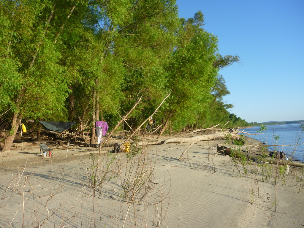
● You will pass mile after mile of beautiful sandy campsites, but when dusk comes your best option will be a muddy, mosquito-ridden bog or a steep slope of broken rocks and concrete revetment.
OK, you’ve braved all those discomforts. Good! Because you will also:
● Be seeing incredible wild beauty every single day, even in the “Chemical Corridor” of Louisiana.
● Camp on your own private beach watching the sun set on the water and listening to the frogs and crickets.
● Pull up to the marina in a picturesque little town that the highways passed by, almost every other day until St Louis. You can stop for lunch and have some of the best hamburgers in the country and a $1 pint in nearly every stop.
● Eat and drink anything you want, to your heart’s content, and never gain a pound.
● Be treated with kindness and respect, sometimes awe, by every person you meet. Everyone will want to talk to you, and many will go out of their way to help you, unsolicited.
● Know the joy–none more precious in my book–of complete freedom. Just the horizon before you, the water beneath you, and yourself as captain of the journey.
 Now it’s time to talk gear.
3 Responses to PLANNING